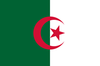
Algeria
|
|

Basic Info
Algeria, officially: the People's Democratic Republic of Algeria) is a country in North Africa on the Mediterranean coast. Its capital and most populous city is Algiers.
The territory of today's Algeria was the home of many ancient cultures and civilizations, including Aterian and Capsian cultures. Its area has known many empires and dynasties, including ancient Berber Numidians, Carthaginians, Romans, Vandals, Byzantines, Arab Umayyads, Fatimids, Berber Almohads and later Turkish Ottomans.

Geography
Algeria is the largest country in Africa, the Arab world, and the Mediterranean Basin. Its southern part includes a significant portion of the Sahara. To the north, the Tell Atlas form with the Saharan Atlas, further south, two parallel sets of reliefs in approaching eastbound, and between which are inserted vast plains and highlands. Both Atlas tend to merge in eastern Algeria. The vast mountain ranges of Aures and Nememcha occupy the entire northeastern Algeria and are delineated by the Tunisian border. The highest point is Mount Tahat (3,003 m).
Climate
In this region, midday desert temperatures can be hot year round. After sunset, however, the clear, dry air permits rapid loss of heat, and the nights are cool to chilly. Enormous daily ranges in temperature are recorded.
Religion
islam is the predominant religion with 99% of the population. Almost all Algerian muslims follow Sunni islam, with the exception of some 200,000 Ibadis in the M'zab Valley in the region of Ghardaia.
Administrative divisions
Algeria is divided into 48 provinces (wilayas), 553 districts (daïras) and 1,541 municipalities (baladiyahs). Each province, district, and municipality is named after its seat, which is usually the largest city.
|

|
|
Site Search
News
Random Articals
Weather
Join Our Newsletter
Send This Page to Friend
To Email this page to a friend
1. Use Your Default Email Client
2. Use Our Recommend Page
Online Contact
nouahsark
1438084734
+ 86 158 00 323 707
+ 86 158 00 323 707
nouahsark@hotmail.com

If you like this article please feel free to share it to your favorite site listed below: