
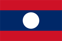
Laos
|
|
Basic Info
Laos, officially the Lao People's Democratic Republic, is a landlocked country in Southeast Asia, bordered by Burma and China to the northwest, Vietnam to the east, Cambodia to the south, and Thailand to the west. Its population was estimated to be around 6.5 million in 2012.
Laos traces its history to the kingdom of Lan Xang, which existed from the 14th to the 18th century when it split into three separate kingdoms. In 1893, it became a French protectorate, with the three kingdoms, Luang Phrabang, Vientiane and Champasak, uniting to form what is now known as Laos. It briefly gained independence in 1945 after Japanese occupation, but returned to French rule until it was granted autonomy in 1949. Laos became independent in 1953, with a constitutional monarchy under Sisavang Vong. Shortly after independence, a long civil war ended the monarchy, when the Communist Pathet Lao movement came to power in 1975.

Geography
Laos is the only landlocked country in Southeast Asia, and it lies mostly between latitudes 14° and 23°N (a small area is south of 14°), and longitudes 100° and 108°E. Its thickly forested landscape consists mostly of rugged mountains, the highest of which is Phou Bia at 2,818 metres (9,245 ft), with some plains and plateaus. The Mekong River forms a large part of the western boundary with Thailand, whereas the mountains of the Annamite Range form most of the eastern border with Vietnam and the Luang Prabang Range the northwestern border with the Thai highlands. There are two plateaux, the Xiangkhoang in the north and the Bolaven Plateau at the southern end. The climate is tropical and influenced by the monsoon pattern.
Climate
Laos has a tropical monsoon climate, with a pronounced rainy season from May through October, a cool dry season from November through February, and a hot dry season in March and April. Generally, monsoons occur at the same time across the country, although that time may vary significantly from one year to the next. Rainfall also varies regionally, with the highest amounts-- 3,700 millimeters (145.7 in) annually—recorded on the Bolovens Plateau in Champasak Province.
City rainfall stations have recorded that Savannakhét averages 1,440 millimeters (56.7 in) of rain annually; Vientiane receives about 1,700 millimeters (66.9 in), and Louangphrabang (Luang Prabang) receives about 1,360 millimeters (53.5 in). Rainfall is not always adequate for rice cultivation, however, and the relatively high average precipitation conceals years where rainfall may be only half or less of the norm, causing significant declines in rice yields. Such droughts often are regional, leaving production in other parts of the country unaffected. Temperatures range from highs around 40 °C (104 °F) along the Mekong in March and April to lows of 5 °C (41 °F) or less in the uplands of Xiangkhoang and Phôngsali in January.
Religion
Of the people of Laos 67% are Theravada Buddhist, 1.5% are Christian, and 31.5% are other or unspecified according to the 2005 census. Buddhism has long been one of the most important social forces in Laos.
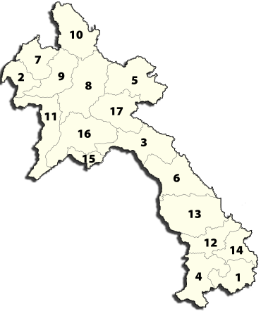
Administrative divisions
Laos is divided into 16 provinces (khoueng) and one prefecture (kampheng nakhon) which includes the capital city Vientiane (Nakhon Louang Viangchan). Provinces are further divided into districts (muang) and then villages (ban). An 'urban' village is essentially a town.
|
Site Search
News
Random Articals
Weather
Join Our Newsletter
Send This Page to Friend
To Email this page to a friend
1. Use Your Default Email Client
2. Use Our Recommend Page
Online Contact
nouahsark
1438084734
+ 86 158 00 323 707
+ 86 158 00 323 707
nouahsark@hotmail.com
If you like this article please feel free to share it to your favorite site listed below: