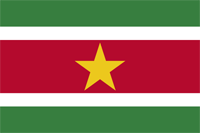
suriname
|
|

Basic Info
Suriname (or Surinam), officially known as the Republic of Suriname, is a country in northern South America. It is bordered by French Guiana to the east, Guyana to the west, Brazil to the south and the Atlantic Ocean to the north. Suriname was first colonized by the British, and captured by the Dutch in 1667, who governed it as Dutch Guiana until 1954.
In 1954 it became one of the constituent countries of the Kingdom of the Netherlands. The country of Suriname achieved independence from the Kingdom of the Netherlands on 25 November 1975. Suriname, the Netherlands Antilles (until its dissolution in 2010) and the Netherlands itself have cooperated on a basis of equality since 1954.
It is also a member of CARICOM and is considered as a Caribbean country that is not an island. Suriname, neighbouring Guyana, France (through its overseas department of French Guiana) and Brazil are the only four countries in South America that have a non-Spanish speaking population with English (Guyana), Dutch (Suriname), Portuguese (Brazil) and French (French Guiana) languages.

Geography
Suriname is the smallest independent country in South America. Situated on the Guiana Shield, it mostly lies between latitudes 1° and 6°N, and longitudes 54° and 58°W. The country can be divided into two main geographic regions. The northern, lowland coastal area (roughly above the line Albina-Paranam-Wageningen) has been cultivated, and most of the population lives here. The southern part consists of tropical rainforest and sparsely inhabited savanna along the border with Brazil, covering about 80% of Suriname's land surface.
Climate
Lying 2 to 5 degrees north of the equator, Suriname has a very hot tropical climate, and temperatures do not vary much throughout the year. Average relative humidity is between 80% and 90%. Its average temperature ranges from 84 to 97 degrees Fahrenheit (29 to 34 degrees Celsius). Due to the high humidity, actual temperatures are distorted and may therefore feel up to 11 degrees Fahrenheit (6 degrees Celsius) hotter than the recorded temperature. The year has two wet seasons, from April to August and from November to February. It also has two dry seasons, from August to November and February to April.
Administrative divisions
Suriname is divided into ten districts:
1 | Brokopondo |  |
2 | Commewijne | |
3 | Coronie | |
4 | Marowijne | |
5 | Nickerie | |
6 | Para | |
7 | Paramaribo | |
8 | Saramacca | |
9 | Sipaliwini | |
10 | Wanica |
Site Search
News
Random Articals
Weather
Join Our Newsletter
Send This Page to Friend
To Email this page to a friend
1. Use Your Default Email Client
2. Use Our Recommend Page
Online Contact
nouahsark
1438084734
+ 86 158 00 323 707
+ 86 158 00 323 707
nouahsark@hotmail.com

If you like this article please feel free to share it to your favorite site listed below: