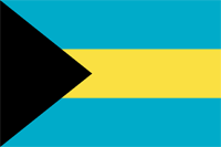
bahamas
|
|

Basic Info
The Bahamas officially the Commonwealth of the Bahamas, is a country consisting of more than 3,000 islands, cays and islets in the Atlantic Ocean, north of Cuba and Hispaniola (the Dominican Republic and Haiti), northwest of the Turks and Caicos Islands, southeast of the U.S. state of Florida and east of the Florida Keys. Its capital is Nassau on the island of New Providence. Geographically, the Bahamas lie near to Cuba, which is part of the Greater Antilles, along with Hispaniola and Jamaica.
The designation of "Bahamas" refers to the country and the geographic chain that it shares with the Turks and Caicos Islands. The three West Indies/Caribbean island groupings are: The Bahamas, The Greater Antilles and The Lesser Antilles. As stated on the mandate/manifesto of The Royal Bahamas Defence Force, The Bahamas territory encompasses 180,000 square miles of ocean space. From the Cay Sal Bank and Cay Lobos (just off of the coast of Cuba) in the west, to San Salvador, The Bahamas is much larger than is recorded in some sources.

Geography
The country lies between latitudes 20° and 28°N, and longitudes 72° and 80°W.
In 1864, the Governor of the Bahamas reported that there were 29 islands, 661 cays, and 2,387 rocks in the colony.
Climate
The climate of the Bahamas is subtropical to tropical, and is moderated significantly by the waters of the Gulf Stream, particularly in winter. Conversely, this often proves very dangerous in the summer and autumn, when hurricanes pass near or through the islands. Hurricane Andrew hit the northern islands during the 1992 Atlantic hurricane season, Hurricane Floyd hit most of the islands in 1999 and Hurricane Irene traversed the entire length of the archipelago as a major hurricane in 2011.
Etymology
The origin of the name Bahamas, derives from the Spanish baja mar ("Shallow Water"). In English, the Bahamas is one of only two countries whose official name begins with 'the', along with the Gambia.
Administrative divisions
The districts of the Bahamas provide a system of local government everywhere except New Providence, whose affairs are handled directly by the central government. In 1996, the Bahamian Parliament passed "The Local Government Act" to facilitate the establishment of Family Island Administrators, Local Government Districts, Local District Councillors, and Local Town Committees for the various island communities. The overall goal of this act is to allow the various elected leaders to govern and oversee the affairs of their respective districts without the interference of Central Government. In total, there are 38 districts, with elections being held every five years. There are also one hundred and ten Councillors and two hundred and eighty-one Town Committee members to correspond with the various districts. See The Map
Site Search
News
Random Articals
Weather
Join Our Newsletter
Send This Page to Friend
To Email this page to a friend
1. Use Your Default Email Client
2. Use Our Recommend Page
Online Contact
nouahsark
1438084734
+ 86 158 00 323 707
+ 86 158 00 323 707
nouahsark@hotmail.com

If you like this article please feel free to share it to your favorite site listed below: